In collaboration with local organizations and public agencies, SF Parks Alliance is revamping efforts around the Blue Greenway: an initiative that will elevate and connect 13 miles worth of waterfront parks and public spaces along San Francisco’s southeast waterfront, from Oracle Park south to Candlestick Point.

Contact

MayaR@sfparksalliance.org

Blue Greenway
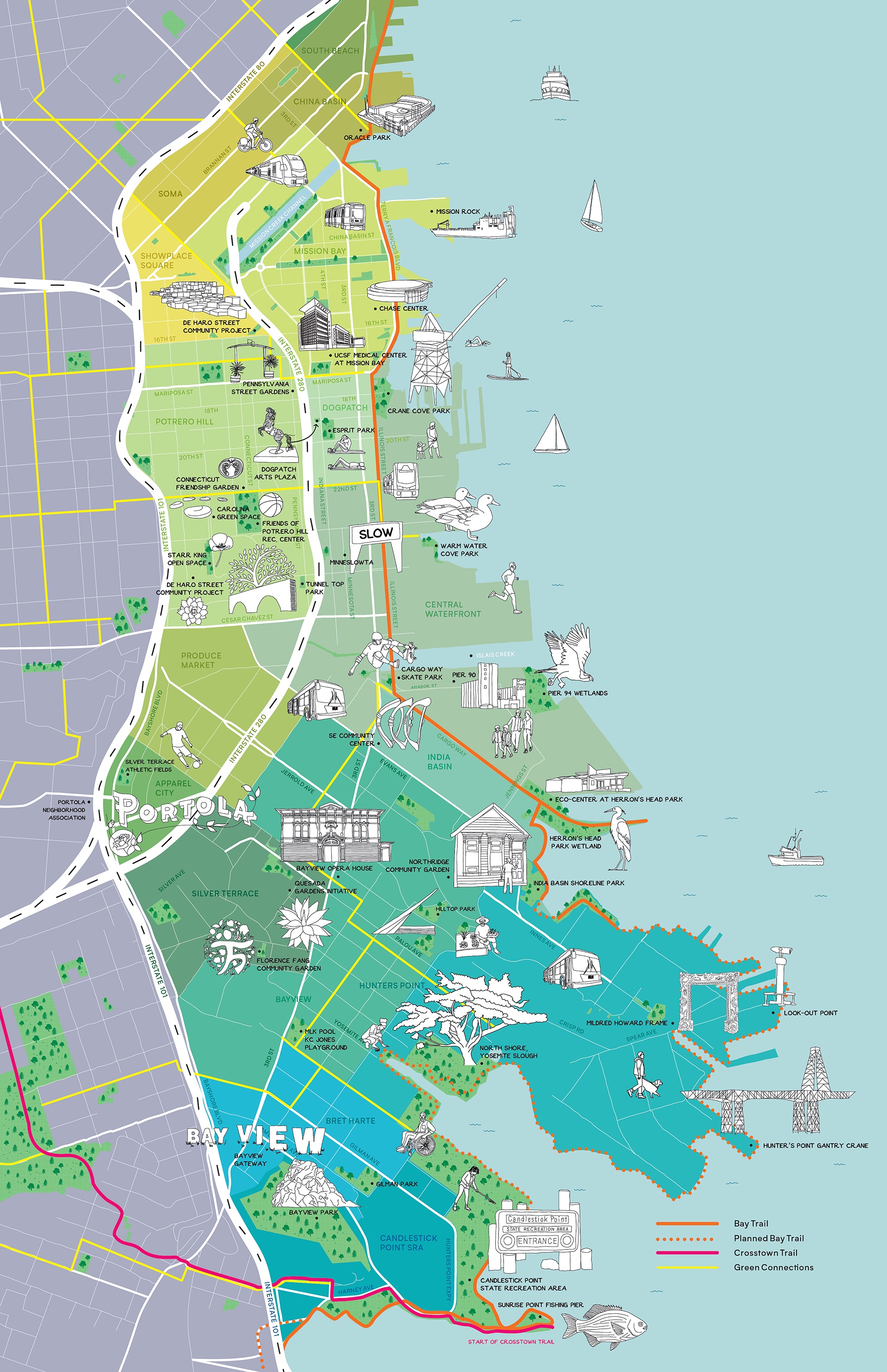
An illustrated map that highlights parks, public spaces, and trails within the Blue Greenway, an area of southeast San Francisco which is bounded on the north by Oracle Park, the south by Candlestick Point, the west by the 101 freeway, and the east by the waterfront.

The Vision

The Blue Greenway and its network of parks, trails, and open spaces will connect neighbors to their waterfront and serve as a catalyst for community building, employment opportunities, and economic vitality by providing active transportation routes between SF’s eastern neighborhoods and the employment centers of Mission Bay and downtown.

The Process

SF Parks Alliance, in collaboration with local organizations, public agencies, and neighbors, is revamping efforts to turn the vision for the Blue Greenway into a reality. Through bringing together diverse stakeholders, we aim to transform formerly unusable land parcels into areas for community enjoyment, active recreation, and economic activity.

The Environmental Impact

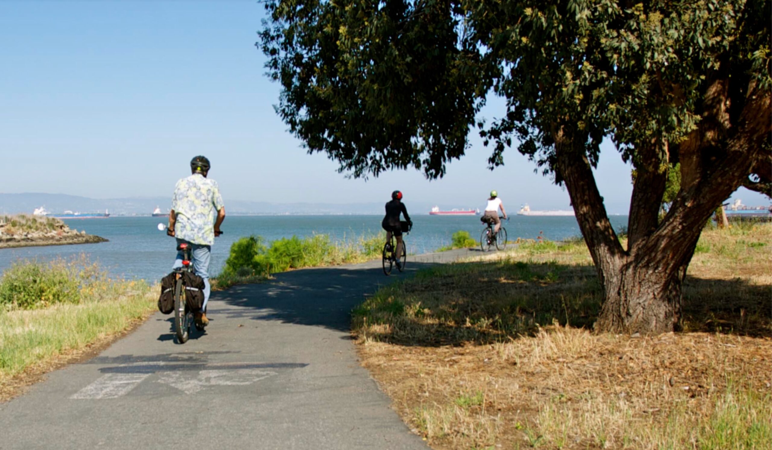
This initiative involves the clean-up of toxic contaminants left behind by former maritime industries, reforming unusable waterfront parcels into open spaces for active transportation and recreation. As of 2023, the Blue Greenway’s northern portion has undergone many such renovations, significantly improving the shoreline’s environmental resilience and waterfront access for nearby communities.

Crane Cove Park opened in 2020 along San Francisco’s Central Waterfront, transforming a formerly inaccessible industrial shoreline. New amenities are in the works for the 7-acre park, including two distinct children’s play areas and a dog run.

Today, fences block access to much of the central waterfront. Future plans will rejuvenate this historic San Francisco area, with a sensitive balance of change and preservation into a clean and livable neighborhood.

The India Basin Waterfront Parks Project endeavors to build a grand 10-acre waterfront park, combining the existing India Basin Shoreline Park area with the 900 Innes property. The project will close a critical gap in the San Francisco Bay Trail and transform a post-industrial brownfield into a spectacular park, all with an emphasis on public access, social equity, waterfront recreation, resiliency to sea-level rise, and habitat and wetland restoration.

The India Basin Shoreline Park basketball court was resurfaced and transformed into a multiuse hypecourt in 2022. SF Parks Alliance worked with Nina Fabunmi, a local artist who is a part of the Hunters Point Shipyard Artists community. She and a cohort of local youth designed and painted the court.

The southernmost part of the Blue Greenway includes vast open space, the Yosemite Slough wetland restoration project, new dwelling units, some industrial development, and California’s first urban state park. Once complete, the Shipyard and Candlestick Point together will include a total of 332 acres of open space.

Blue Greenway Events

Sankofa Makers Market

July 16, 2023 @ 11:00 am - 3:00 pm

Sankofa Makers Market

July 9, 2023 @ 11:00 am - 3:00 pm

Sankofa Makers Market (CANCELLED)

July 2, 2023 @ 11:00 am - 3:00 pm

Keep in touch!

Sign up for our monthly newsletter for updates on all things parks and public spaces taking place across San Francisco.

Thank you for subscribing to our newsletter!

Something went wrong when trying to subscribe you. Please try again later or contact us.